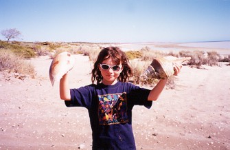
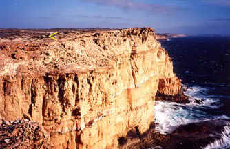
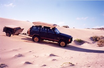
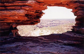
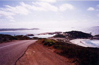
Went to the top of the Francois Peron NP. which is all very deep sand 4wdrive tracks and picked up some good looking shells and two full cans of beer which we left for someone else to enjoy. It was then time to visit the most westerly point of Australia at Steep point which requires a lot of rough 4wdrive tracks running over steep dunes and a few hours of driving you come out on top of a cliff. It was the first time we saw others while 4wdriving as they were there to do deep water shark fishing straight of the cliff. It was then south to the Zuytdorp Cliffs that are very high and in front of the arrow you can just make out the white camper pack and trailer lid in the photo below right.
Collecting shells and the Zuytdorp Cliffs at Steep Point.
It was how ever very hot and windy and took some effort not to get blown over as you can see by Lisa's heavy pony tail getting blown backwards. We kept following along the top of the cliff often were there was no tracks visible because of the sharp rocks in sections but came across some great spots and little fishing shacks in some beautiful bays. Even manage to find away back to the main track leading in which cut out all the narrow steep sections we had on the way in where there was no room to pass if you came across someone. When we fueled up at the Roadhouse back at the highway and told the owner about it, he had never heard you could do it and grabbed a new map off the shelf so I could draw on it where to go. He was going to try it that night after closing up so he could be fishing quicker.
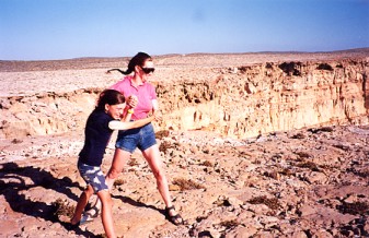
Fighting the wind and dune running.
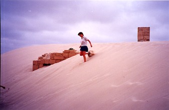
Further down the coast we checked out Kalbarri NP. for some good scenery and some swimming while hiking along the valley floor. There was quite alot of abseiling going on as well at the cliff tops. The Pinnacles are visited by alot of tourist as they have made a good road into it but there is still a 4wdrive track through the sand dunes all the way to Lancelin some 70 kms further south.
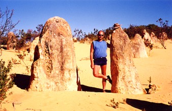
Kalbarri NP. and the posing at the Pinnacles.
Following the coast to the capital city of Perth it took some adapting again to the traffic and noise of a city and visited Rottnest Island which is good for snorkeling as they have an under trial you can follow with information boards under the water. Sticking to the coast we looked at the famous wine growing and hot surfing area of Margaret River before hitting the most south west point of Australia ( I have been to all 8 extreme points of Australia now ). It was time to head east for the first time visiting Albany and Natural Bridge where the arrow points to me sitting on the edge. Came across some bush fires on the way to Esperance which made for a good sunset but not a good camp site.
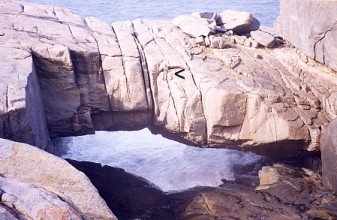
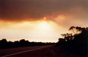
Sitting on Natural bridge Albany and fire outside Esperance.
We made our way across to Kalgoorlie before heading across the Nullarbor plain which has a 90 mile section in it without a single bend and continued on the 3000 kms east to home. Stopped off near the border to see that there wasn't much left of the Eucla Telegraph Station as it is slowly got a sand dune moving over it but was interesting to see that more was appearing from the other side as it is passes over. Fowlers bay is great to look around in with the only bit of grass being for the tent site in the whole town as it is always fighting back the dunes trying to take over the town.
Bay of Isles and the smothered Eucla Telegraph Station.
It may have been the hottest trip we have ever done with everyday making it over 100*F but we did get respite from the heat while in the car with the air-conditioning on. That makes it harder on the car at times but it did not miss a beat for the whole 15,500 kms or 9,700 miles of some very rough terrain and worse conditions than most would have had on the same trip and have heard and seen countless failures on more so called capable vehicles.