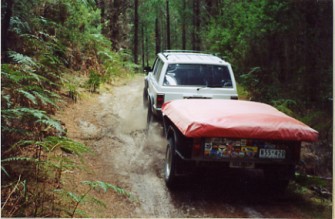
Heading further north we checked out the Franklin River trail just past Derwent Bridge township. This river came to world prominence when they started to build a dam for another large hydroelectric power station. The protestors blocked the roads and stopped all work. There were hundreds of people from around the world that took part and in the end the federal government declared it a World Heritage Area. But thanks to the track they cut in you can now see the area which you never had been able to access before. You must have a clean car once again and have the same inspection etc before you get your key. Like before they limit the numbers very much but we were able to get in no problem. The office is in Queenstown of the Parks and Wildlife Services where the permit and key is obtained. Use the book on page 85 for all the details on the Mt. McCall Track as it is known. It is also worth taking the side track down to Bird River bridge which is down an old tram track to a coastal town of Pillinger which was used as a port for the mine. There are still remnants down there of the town and jetty. Goes through very high narrow cuttings but be careful as we nearly collected a Police 4wd who was showing his family around.
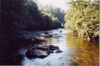
The beautiful Franklin river.
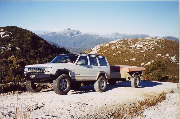
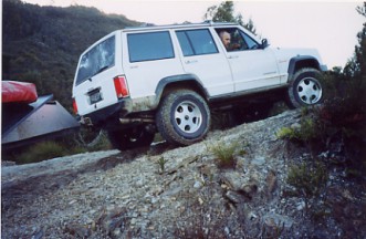
Once through the locked gate the track starts off well and is quite wide. They made it to take trucks to bring in all the materials for the dams construction. Once you reach a helipad however, everything changes. It is funny to be driving through the bush only to come across this large tarred area where supplies were left to be transferred to the dams site by helicopter. There is still a anti dam message painted in huge letters on the landing pad from all those years ago. After this the track becomes narrow and rocky and winds its way through the scrub. Once out of the trees you climb over Mt Cutcheon and Mt McCall with the best views of any part on the west coast if not the whole of Tasmania. You can see all the way to the back side of Frenchmans Cap which cannot be seen from this side from anywhere else. To get to the cap itself takes 3 days of walking from the other side all together. The track is very steep near the end but as it is on solid rock there is plenty of traction available. You end up 300 meters above the dam site at an old haulage that was made to lower the supplies down to the river. It is very steep climb down to the water and is not recommended by the authorities.
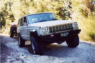
( click it for big pic. ) Got access to the locked trail to the Franklin river dam site.
Back in Queenstown we went on the rack and pinion railway. This was built for the local mine and used to be the only access to this side of the island. They had some very steep climbs so they used the Swiss system of having a central driven cog in the middle of the steam locomotive which engaged in the toothed rail in between the tracks for a part of it. As is turned out we were there to see the first ever passengers come all the way through from Strahan since the railway had been restored to its full length. Before that you could do a part from this end up and back and then drive to the other end to do a section there. So we booked onto the first one to run all the way from the Queenstown end down to the coast at Strahan. You can then take a bus back or the train for the return journey.
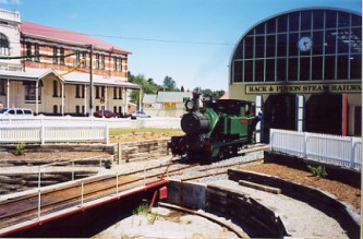
On the first ever Rack & Pinion Railway ride from Strahan to Queenstown.
Strahan is a great place to hang out and most people come here to take a cruise up the Gordon river. We headed south to Macquarie Heads to where you are allowed to camp on the shores of the harbour. The next day we headed out along the beach ( see page 78 ) along the Ocean Beach. There are a lot of warnings out about 4x4's being lost to the quick sand along the way where the water runs out from under the sand dunes. They recommend 3 vehicles with recovery gear to try and haul them out as any delay makes it impossible. Well we spoke to some locals about it and they say it does happen but is worse in the winter when more water runs over the sand. We had no problems at all but did not stop in the wet areas at the foot of dunes either. It is a lot of fun to drive along here and we stopped for a picnic too. You can go about 8 kms north to the Henty River mouth from the exit too but it is rare to be able to cross the river and keep going due to the river flow. We played around on the sand tracks through the forest as well so plenty to do here.
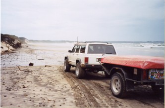
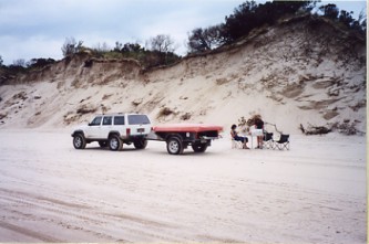
Got to watch out for quick sand here! Great place for a picnic further along though.