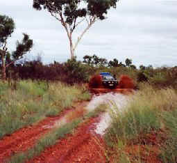
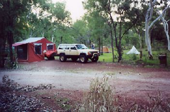
We camped the night behind the Cacoory ruins and surprised some stockmen skinny dipping in the water hole after a long day mustering stock. We made our way to Boulia and then on to Mount Isa where we saw tar and traffic lights for the first time in 5 days of travelling. The place is a mining town which is the world's largest producer of silver and has all the conveniences like supermarkets and K-mart etc. Quite a sight seeing we hadn't been able to even buy fresh bread let alone anything like this for 5 days. Unfortunately it had started to rain due to a cyclone off the coast which completely cut of our planned route north due to the flooding of all the 4WD tracks we wanted to take to Lawn Hill N.P. and through Hells gate and then following along the coast until we got to Roper Bar. This was going to take a week to complete so we had to come up with an alternative route and fast as the rivers all around us were rising. The rain had at least brought the temperature down a few degrees from the high 30's ( 100°F ) and low 40's ( 108°F ) we had been having before. The road west seemed the best way as at least we wouldn't be following the bad weather across Australia as our weather travels from west to east. The highway to Three Ways had opened and we headed off to Camooweal Caves on a narrow strip of tar only wide enough for one car so we had to drop a wheel off into the dirt that was still wet and muddy in sections and pull over completely if we met a road train. The 4WD Track to the caves hadn't been driven by anyone since the rain so there was a lot of slipping around with plenty of mud holes to get through. You have to abseil down into the caves if you want to see more than the entrance, but with the heat up around 100°F again, Ken didn't feel like getting his gear out. This would make a great camp site as well with a picnic shelter, water tank and a lagoon to swim in.
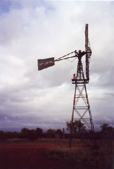
Red mud on the track into Camooweal Caves and daughter up a windmill!
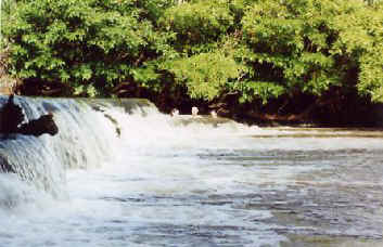
Back on the road again it improved as soon as we crossed into the Northern Territory and with open speed limits, it is probably just as well! It was on this section of road that we caught sight of 5 Porsche 4WD's being tested for high speed and heat with a V8 Grand Cherokee and a Mercedes 4WD for comparison. They were doing about 160 kmh (100 mph) at the time and heading towards a flooded part of the highway which was around a bend and a foot under water for a good 3 Olympic pool lengths. Would have made a most interesting sight to see what would happen hitting water at that speed! I almost turned around to follow them. Later we also had 10 more of their cars fly past us with a combination of unreleased 911's and Boxsters plus current models. At the next roadhouse we stopped at for fuel they said they had been clocked doing 280 kmh ( 175 mph ) the day before, they were worried what would happen if they had hit some of the wild Water Buffalo that had been walking around on the road as well as kangaroos and cattle. Most of the roads are not fenced and we saw a lot of cattle that would stay on the road until we had used the horn a lot and they then got out of your way (thats why I run air horns with 3 compressors!). From there I hoped that we could go up the Tablelands Hwy but reports through from the cattle stations that morning said that it had gone under water by 6 feet in places and was impassable. So it was on to Three Ways and up the Stuart Hwy to bathe in the Mataranka Thermal pools where the water is crystal clear and warm surrounded by tropical forest and we camped nearby in Elsey N.P which was deserted. From here north you are in a far more green area with lots of grass and trees instead of the more desert areas that we had been travelling in further south. There is a nice walk along the river to Mataranka falls that we undertook in the morning and swam there as well.
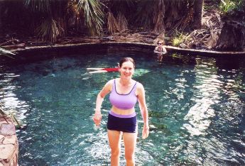
My wife enjoying the Thermal Pools and our camp at Elsey N.P
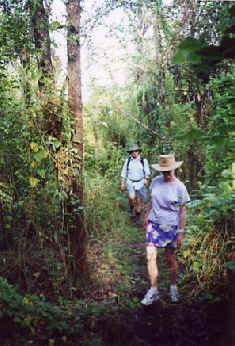
Jungle walk to Mataranka Falls and cooling off
[BACK][1][2][3][4][5][6][7][8][NEXT]